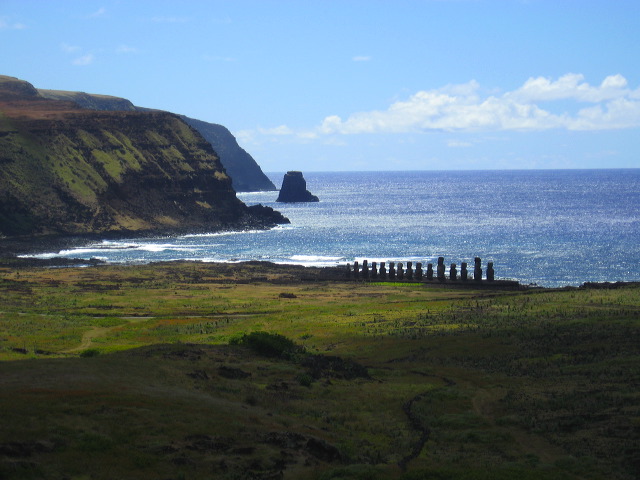
The large flat plain below Rano Raraku provided easy access to the quarry and as a result the largest of the moai where erected here at Ahu Tongariki. However, in 1960, a massive tidal wave generated by an earthquake off the coast of Chile hit Ahu Tongariki and destroyed the platform and swept the massive moai hundreds of yards inland.